Given its predominantly arid climate, the Middle East and North Africa (MENA) is considered a regional water stress hotspot, amplified by the rising demands associated with its rapid urbanization and population growth. The scarcity of renewable water resources across the MENA region requires improved monitoring of available precipitation and terrestrial water storage to quantify water budget deficits and implement targeted water resource management strategies. However, accurate and timely monitoring of precipitation remains a challenge, particularly in arid environments, such as those prevalent across the MENA region, due to sparse ground-based observational networks and complex land-atmosphere dynamics.
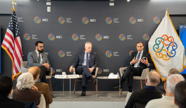
Join us for a panel discussion that will explore the challenges and targeted solutions to using satellite technology for tracking water resources in MENA and how satellite data can be used to improve water resource management and decision-making in the region. The panel will also consider the role of international collaboration and partnerships in addressing these challenges as well as highlight successful case studies and best practices from around the world.
Speakers
Youssef Wehbe
Program Officer, UAE Research Program for Rain Enhancement Science, and Non-Resident Scholar Climate and Water Program, Middle East Institute
Raha Hakimdavar
Founder & CEO, Zyon Space, and Non-Resident Scholar Climate and Water Program, Middle East Institute
Enrique R. Vivoni
Fulton Professor, Hydrosystems Engineering, and Director, Center for Hydrologic Innovations, School of Sustainable Engineering and Built Environment, and the Global Futures Laboratory, Arizona State University
William Straka
Researcher, Cooperative Institute for Meteorological Satellite Studies, University of Wisconsin
Mohammed Mahmoud, moderator
Climate and Water Program Director, Middle East Institute
Detailed Speaker Biographies
Youssef Wehbe
Dr. Youssef Wehbe is a Non-Resident Scholar with the Climate and Water Program at the Middle East Institute. His areas of expertise include water resource management, coupled land-atmosphere modeling, cloud microphysics, and weather modification technology. His ongoing research addresses next-generation water resource monitoring by integrating satellite and radar remote sensing, hydro-meteorological modeling, and relevant applications of AI/machine learning tools. Youssef is a Program Officer for the UAE Research Program for Rain Enhancement Science, an international merit review research program under the UAE National Center of Meteorology designed to stimulate and promote scientific advancement and the development of new technology in this area. His main role consists of project management and oversight by spearheading the monitoring and evaluation mechanism for awarded institutions across the UAE, U.S., U.K., China, Finland, Germany, Japan, and Russia. His tasks also include managing research output in terms of intellectual property, data repositories, and publications, in addition to screening proposal submissions and supporting the program’s overall science mission and roadmap.
Raha Hakimdavar
Dr. Raha Hakimdavar is the Director of Space Sciences at Ball Aerospace, where she develops business strategy and leads engagements with the government and broader space sciences community. She also serves as an adjunct professor in water and climate science at Georgetown University’s School of Foreign Service. Her areas of expertise include hydrology, hydro-ecology, and space sciences and applications. Previously, Dr. Hakimdavar served as a hydrologist and acting national program lead in remote sensing and geospatial analysis research at the USDA Forest Service, where she developed innovative approaches to manage forest and aquatic resources in the United States and internationally. She led research on the integration of space data into the UN Sustainable Development Goals and developed a whole of government framework for a global hydrology model to assess water risk during her Presidential Management Fellowship appointment at the NASA Goddard Space Flight Center. Dr. Hakimdavar has consulted for UN Environment and the World Bank in the Caribbean and Latin America, notably helping to establish the first remote hydro-meteorological network for disaster risk reduction, agroforestry, and hydropower development in the South Department of Haiti.
Enrique R. Vivoni
Enrique R. Vivoni is the Fulton Professor of Hydrosystems Engineering in the School of Sustainable Engineering and the Built Environment and the Director of the Center for Hydrologic Innovations at Arizona State University. His research focuses on water, climate and ecosystem processes and interactions with sustainability and management, with a specific emphasis on semiarid and arid regions of North America. Over the course of his career, Professor Vivoni has established long-term research collaborations on topics related to advancing numerical models, water resources management, climate change and sociopolitical interactions with natural resources. He is also involved in training, outreach and stakeholder engagement activities as related to technology transfer and the use of scientific knowledge for improving decision-making processes. He has won a number of local and national awards, including the AAAS Lifetime Fellow, Fulbright Fellowship, Leopold Leadership Fellowship, Huber Prize for Civil Engineering Research, Quentis Mees Research Award from the Arizona Water Association, and the Presidential Early Career Award for Scientists and Engineers. He has served in administrative positions including as Associate Dean of the Graduate College, Associate Director of the School of Earth and Space Exploration, and Graduate Faculty Chair of the Hydrosystems Engineering Program.
William Straka
William Straka is a researcher with the Cooperative Institute for Meteorological Satellite Studies (CIMSS) at the University of Wisconsin, where he has been working for over 17 years. Currently, he focuses on a number of topics, including the utilization of the Day Night Band as well as interacting with the US National Weather Service as well as US and international emergency response stakeholders such as FEMA, IPNE (Brazil) and several agencies within the United Nations regarding the distribution and utilization of the NOAA LEO/GEO Flood Product as other US satellite products for disaster monitoring and response. He is currently working with the World Meteorological Organization to help with expanding the use of satellite derived products which can be used for monitoring conditions during various stages of flood events.
Mohammed Mahmoud, moderator
Mohammed Mahmoud is the Director of the Climate and Water Program and a senior fellow at the Middle East Institute. His areas of expertise include climate change adaptation, water policy analysis, and scenario planning. Mohammed has held leadership positions in several organizations, most recently as chair of the Water Utility Climate Alliance. Prior to that, Mohammed was president of the North American Weather Modification Council. Mohammed’s professional accomplishments include negotiating and formalizing a 10-year multi-state cloud seeding funding agreement between seven Colorado River Basin states, developing and implementing the first ever climate adaptation plan for a multi-county water district in Arizona, and helping secure a 1.1 million dollar grant from NASA for Arizona State University to study the impacts of climate change on the hydrology of the western United States. Mohammed has conducted water-management research and work for the Middle East and North Africa region; most extensively on the Nile River Basin. Mohammed’s other water management work in the region explored formalizing the administration of Saudi Arabia’s groundwater resources by using other established groundwater management frameworks as application templates, such as Arizona’s 1980 Groundwater Management Code.
Image by Planet Observer/Universal Images Group via Getty Images


